That first step onto high desert terrain hits differently—no forest canopy, no gentle streams, just endless silence under an immense sky. Hiking in the high desert demands respect for its brutal beauty: where 100°F summer days plummet to freezing nights, and a wrong turn could leave you stranded in a landscape that forgives nothing. This isn’t a casual woodland stroll. Forget everything you know about regular hiking. Here, dehydration lurks in every sunbaked canyon, flash floods roar through slot canyons without warning, and fragile cryptobiotic soil takes decades to heal from a single footprint. But get it right, and you’ll experience solitude and stark majesty found nowhere else on Earth. In this guide, you’ll discover exactly how to conquer high desert trails—from gear that prevents heat stroke to permits for legendary routes like The Wave—so your adventure becomes a story of triumph, not a rescue headline.
Why High Desert Trails Are Nothing Like Forest Hikes (Key Terrain Dangers)
The high desert’s elevation (2,000–7,000 feet) creates a deceptive trap. That crisp, clear air sharpens distant buttes into photogenic backdrops, but it also amplifies UV exposure and accelerates dehydration. Unlike forest trails, you’ll navigate terrain where sandy washes disguise ankle-twisting rocks, volcanic cinder fields swallow footsteps, and slot canyons become death traps during monsoons. One misstep near a crumbling sandstone ledge could send you sliding into a crevice with no cell signal. Crucially, the “rain shadow effect” means no reliable water sources exist—what looks like a promising spring on your map is often a dry tinaja (rock basin) contaminated by wildlife. And those iconic Joshua trees? They offer zero shade. This environment punishes complacency: a study by the National Park Service shows 70% of high desert rescues stem from underestimating these unique hazards.
Spotting Deadly Flash Flood Risks in Slot Canyons
Never enter a narrow canyon if rain falls upstream—even 50 miles away. Monsoon storms (July–September) turn dry washes into 20-foot walls of water in minutes. Before entering, check the National Weather Service’s point-specific forecasts and look for “debris lines” (mud streaks on canyon walls) indicating past floods. If skies darken, retreat immediately to high ground. Pro tip: Carry a satellite messenger like Garmin inReach to alert rescuers if trapped.
Identifying Fragile Cryptobiotic Soil Crusts
That dark, lumpy ground cover isn’t dirt—it’s a living crust of algae and fungi holding the desert together. Step on it, and you’ll undo 100 years of growth. Stick to rock surfaces or sandy washes. When in doubt, freeze and scan: if the surface looks “cracked like dried mud,” stay off it.
Critical Gear Upgrades for High Desert Hiking Safety (Beyond Regular Hikes)
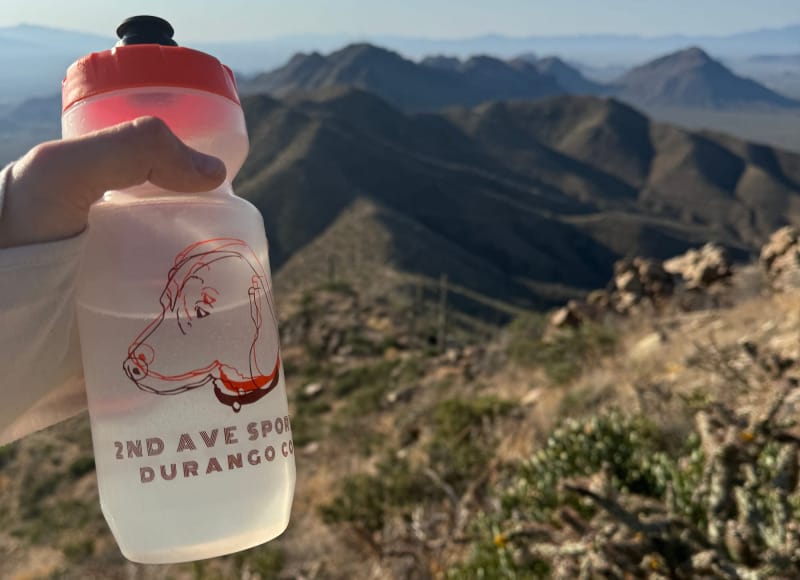
Your standard hiking kit fails here. Insulated water bottles are non-negotiable—uninsulated containers turn your 4 liters of water into scalding liquid by noon. And forget cotton: sweat-wicking sun hoodies and lightweight pants (like Patagonia’s Capilene) block UV rays while preventing chafing. Most hikers skip one life-saver: electrolyte tablets. Without them, you risk hyponatremia—drinking 3+ liters of plain water flushes sodium from your blood, causing confusion and seizures. Always pack salty snacks like jerky or trail mix with nuts.
Must-Have Emergency Gear for Remote Areas
- Personal Locator Beacon (PLB): Cell service vanishes in places like Coyote Buttes. A PLB (e.g., ACR ResQLink) sends GPS coordinates to search teams via satellite.
- Snakebite Kit: Rattlesnakes hide in rock crevices. Use trekking poles to probe ahead and carry a suction device—not for venom extraction (myth!), but to reduce swelling.
- Emergency Bivy: Temperatures drop 30°F after sunset. A space blanket won’t cut it; pack a lightweight bivy sack for hypothermia prevention.
How to Plan Your High Desert Hike: Avoiding Seasonal Disasters

Choosing Your Trail and Season: Spring Wildflowers vs. Summer Heat
Spring (April–May) delivers wildflower explosions—desert marigolds and Mojave asters blanket Arizona’s Painted Desert. But skip June–August unless you hike pre-dawn: Death Valley regularly hits 120°F, causing heat stroke in under 20 minutes. Fall (September–October) offers ideal conditions, but monitor monsoon forecasts for flash flood risks in slot canyons. Winter hikes require caution: snow blocks high-elevation trails like Bryce Canyon’s Rim Trail, and nights dip below freezing. Always call the local BLM office for real-time trail conditions—they’ll warn you about closed roads or dried-up water sources.
Securing High Desert Permits: Wave, Grand Canyon, and More

Permit nightmares sink dreams. The Wave (Coyote Buttes North) requires winning a BLM lottery 4 months ahead—only 64 permits issued daily. Apply online at recreation.gov, or try the Kanab Field Office’s 10 daily walk-up permits (arrive by 9 AM). Grand Canyon backcountry hikes need NPS permits via a weighted lottery; submit 4 months early. For last-minute trips, check the NPS’s 2-day-ahead walk-up lottery at the Backcountry Information Center. No permit? No hike. Rangers turn back unprepared hikers at trailheads.
Navigating High Desert Terrain Without Getting Lost (Real Tips)
GPS apps like Gaia GPS fail when batteries die—a common issue in extreme heat. Always carry a physical USGS map and compass, and practice triangulation at trail junctions. In featureless areas like Nevada’s Great Basin, use “handrails”: follow distinct ridgelines or washes instead of dead-reckoning. If disoriented, S.T.O.P. immediately: Stop, Think, Observe (landmarks), Plan. Never wander—rescuers find 90% of lost hikers within 1 mile of their last known point. Pro tip: Mark your route with biodegradable flagging tape (remove it on return) in slot canyons where exits look identical.
Finding Water in the High Desert: Myths vs. Reality
Myth: “Natural springs are reliable.” Reality: Even documented sources like Utah’s Waterpocket Fold often run dry. Myth: “Cacti provide emergency water.” Reality: Most high desert cacti (cholla, prickly pear) yield toxic fluids. Always carry 4+ liters per person daily—no exceptions. If you find water, filter it aggressively: Colorado River tributaries carry giardia from wildlife. Use a SteriPEN or Aquamira drops, plus a pre-filter for silt. Never ration water: sip 4–8 oz hourly to prevent dehydration-induced confusion.
Top 4 Iconic High Desert Trails for Day Hikers (Bryce to Death Valley)
Bryce Canyon’s Queen’s Garden Trail (Utah)
This 2.9-mile loop drops 550 feet into the amphitheater, winding past hoodoos like Thor’s Hammer. Critical tip: Start at sunrise to avoid afternoon heat and crowds. The Wall Street section (narrow canyon) gets shade by 10 AM—hike it early.
Arches’ Devils Garden Primitive Loop (Utah)
Tackle this 7.2-mile lollipop route to Landscape Arch (the world’s longest natural span). Skip the scramble past Double O Arch unless you have canyoneering experience—unroped drops exceed 15 feet. Best season: October, when surface temps stay below 85°F.
Joshua Tree’s Lost Horse Mine Trail (California)
A 4.8-mile loop through Joshua tree forests to a 1890s gold mine. Watch for cholla cactus “jumping” spines—they detach on contact. Pro tip: Visit in May for desert lily blooms near the mine shaft.
Death Valley’s Zabriskie Point Loop (California)
This 4-mile badlands trek exposes Mars-like terrain. Avoid midday: Manly Beacon’s rocks radiate heat, making surface temps 140°F. Hike at dawn when shadows highlight golden canyon layers.
Preventing Heat Stroke and Dehydration on High Desert Hikes

Heat stroke kills faster here than anywhere. Recognize early signs: stop if you feel clammy, dizzy, or have a headache. Immediate action: strip to underwear, douse yourself with water, and fan your armpits/groin. Prevention beats cure: wear a shemagh (neck gaiter) soaked in water—it cools for hours. Eat salty snacks hourly to maintain sodium levels. Never hike between 10 AM–4 PM in summer; if unavoidable, carry an ice vest under your pack.
Leave No Trace: Protecting Fragile High Desert Ecosystems
One footstep on cryptobiotic soil crust can destroy a network that stabilizes dunes for centuries. Stay on trails—even if bypassing mud. Poop 200 feet from water sources, bury it 6–8 inches deep, and pack out toilet paper in ziplock bags (it doesn’t decompose here). Never touch wildlife: feeding coyotes or desert tortoises alters natural behavior and spreads disease. Pro tip: Use established campsites only—BLM-designated spots have hardened surfaces to minimize impact.
High Desert Hiking Checklist: 10 Must-Pack Items
Forget “nice-to-haves.” These items prevent emergencies:
1. Insulated water reservoir (4+ liters capacity)
2. Wide-brimmed hat + UV-blocking sunglasses (not fashion shades)
3. Sun hoodie + lightweight pants (UPF 50+)
4. Electrolyte tablets (Nuun or Liquid IV)
5. Physical USGS map + compass (pre-marked with route)
6. Satellite messenger (Garmin inReach Mini 2)
7. Emergency bivy sack (SOL Escape Bivvy)
8. Tweezers + antiseptic wipes (for cactus spine removal)
9. High-salt snacks (beef jerky, pretzels)
10. Signal mirror (works without batteries)
Your high desert hike should leave you awestruck—not airlifted. By respecting the terrain’s extremes, packing intelligently, and prioritizing permits, you’ll unlock landscapes of staggering solitude. Remember: the desert doesn’t care about your plans. It rewards only those who prepare relentlessly. Now lace up, check that water reservoir twice, and step into the silence—your adventure in the high desert begins the moment you commit to its rules.